Blog – Page 4 – vanshnookenraggen

vanshnookenraggen logovanshnookenraggen

Blog – Page 4 – vanshnookenraggen

vanshnookenraggen logovanshnookenraggen
Skip to content
  • /home
  • /store
  • /biography
  • /press and podcasts
  • /track maps
  • /historic maps
  • /futureNYCSubway
  • /futureMBTA
  • /unbuilt highways
  • /urban exploration
  • /hyperreal cartography
  • /QueensLink

Archives

Categories

  • Instagram
  • Bluesky
  • Flickr
  • Tumblr
  • Email

Category: Blog (page 4)

We Don’t Need to Replace the BQE, But We Will

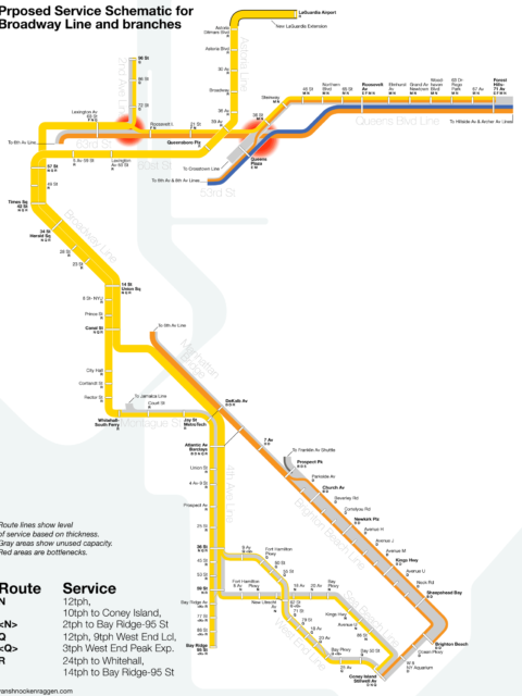
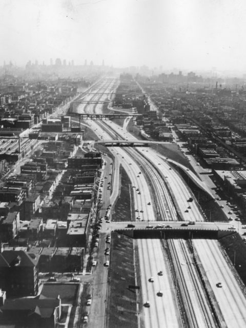
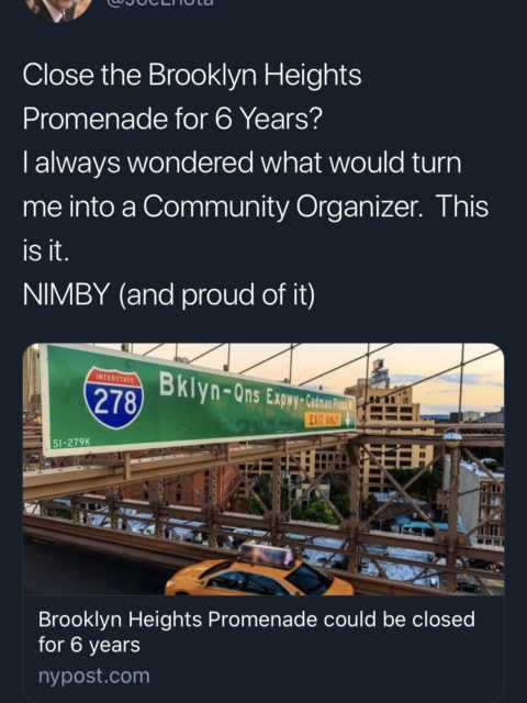
The NYC DOT is looking to rebuild the crumbling Brooklyn-Queens Expressway through Brooklyn Heights with a second elevated highway. But if our various transportation agencies could learn to work together the city wouldn’t have to.
Continue reading “We Don’t Need to Replace the BQE, But We Will”…

The R Train, LaGuardia Airport, and the Ripple Effect in Transit

When it comes to the new LaGuardia AirTrain officials have lost sight of the larger picture. Extending the subway instead would have a system wide benefit. Here’s how.
Continue reading “The R Train, LaGuardia Airport, and the Ripple Effect in Transit”…
Chystie St Connection Poster

Celebrating 50 years of the Chrystie Street Connection

On November 27th, 1967 there was chaos on the New York City…
Continue reading “Celebrating 50 years of the Chrystie Street Connection”…

The Future of the Green Line: From Harvard and Needham to the Seaport

Boston’s subway is straining with new growth. It is time to rethink America’s oldest subway for the 21st Century.
Continue reading “The Future of the Green Line: From Harvard and Needham to the Seaport”…

The Future of the Utica Ave Subway

For future expansion of the system we need to be open to thinking outside the box. How can build the Utica Ave Subway?
Continue reading “The Future of the Utica Ave Subway”…
The new Congress Line in the median of the Congress Expressway, Chicago. 1958 Source: CERA

Build Transit Where It’s Most Effective, Not Where It’s Least Expensive

Transit planners often look for the path of least resistance but this more often than not reduces the effectiveness of transit. Transit should be built where it will be most effective not where it’s cheapest to build.
Continue reading “Build Transit Where It’s Most Effective, Not Where It’s Least Expensive”…

Philadelphia SEPTA & PATCO Vanmap Posters!

What’s your line? Just in time to see the Eagles in Super…
Continue reading “Philadelphia SEPTA & PATCO Vanmap Posters!”…

Boston MBTA: Complete and Geographically Accurate Track Map

Large format prints are available at my vanmaps.com store. I was more…
Continue reading “Boston MBTA: Complete and Geographically Accurate Track Map”…

The Future of the 2nd Avenue Subway

We are designing the world’s most expensive subway and it won’t help most New Yorkers. Here’s how we can change that.
Continue reading “The Future of the 2nd Avenue Subway”…

NYC Subway: Complete and Geographically Accurate Track Map

Collecting every historical map I could find, using GIS data, satellite imagery (both current and historic), YouTube videos of fan trips, my own observations looking out the window of trains through tunnels, and talking to retired track workers I was able to draw what I believe to be the most accurate track map of the NYC Subway ever.
Continue reading “NYC Subway: Complete and Geographically Accurate Track Map”…

Should there even be a One Seat Ride to the Airport?

Does NYC really need a one seat ride to its airports?
Continue reading “Should there even be a One Seat Ride to the Airport?”…
Proposed Queens Plaza Infill Station on the 63rd St Line.

Improving Transit with Midtown East Rezoning

The new Midtown East Rezoning will put a strain our already maxed out subway system. What is something we can do quickly to relieve the pressure?
Continue reading “Improving Transit with Midtown East Rezoning”…
« 1 2 3 4 5 6 … 8 »
© 2025 vanshnookenraggen | Using Receptar WordPress theme. | Privacy Policy | Back to top ↑