Printed on Satin finish 80# cover stock – 220 GSM. Made in the USA! Standard production time is 5 Days. Please add more time for shipping.
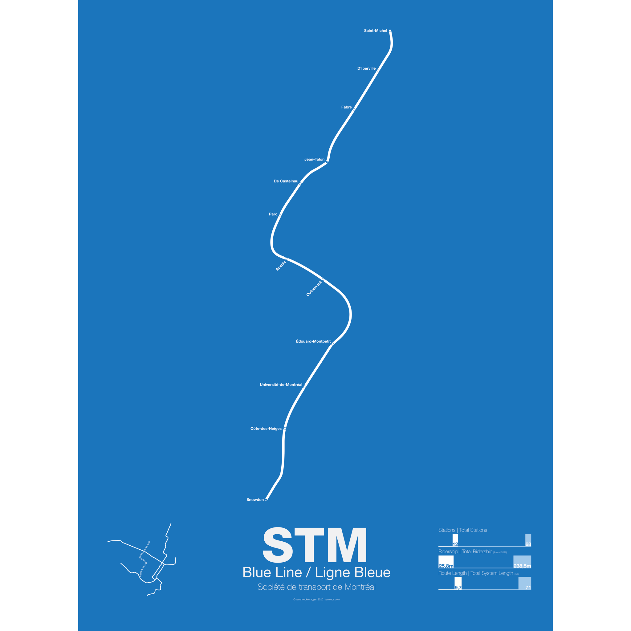

STM Blue Line / Ligne Bleue Poster
$30.00 – $80.00
Additional information
| Weight | N/A |
|---|---|
| Dimensions | N/A |
| Size | Framed 18"x24", 18” x 24”, 24” x 36” |
Related products
-
 $30.00 – $80.00
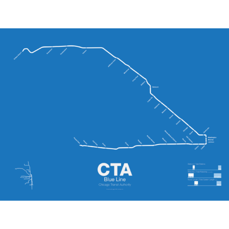
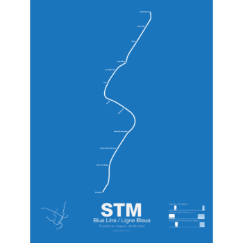
What today is the Blue Line started in 1895 as the Metropolitan West Side Elevated Railroad with service from Canal St to Logan Sq. Soon branches were added to Garfield Park, Humboldt Park, and Douglas Park. The Met, as it was known, has seen the most dramatic changes of all the Chicago “L” lines: the Humboldt Park and Logan Sq branches were removed when service was rerouted through the new Milwaukee-Dearborn Subway in 1951 and subsequently extended along the Kennedy Expressway to Jefferson Park in 1970 and then to O’Hare Airport in 1984. The Garfield Park branch was completely rebuilt along the median of Interstate 290 in 1958. In 2008 the Douglas Branch was rerouted along the Paulina Connector (a left over section of track from the old Logan Sq branch) to connect to the Loop and rebranded as the Pink Line.
The modern sections of the Blue Line were the first examples of rapid transit running along a high median in the US. The Blue Line, along with the Red Line, are the only two services of the CTA which run 24 hours a day.
Printed on Satin finish 80# cover stock – 220 GSM. Made in the USA! Standard production time is 5 Days. Please add more time for shipping.
Select options This product has multiple variants. The options may be chosen on the product page -
 $30.00 – $80.00
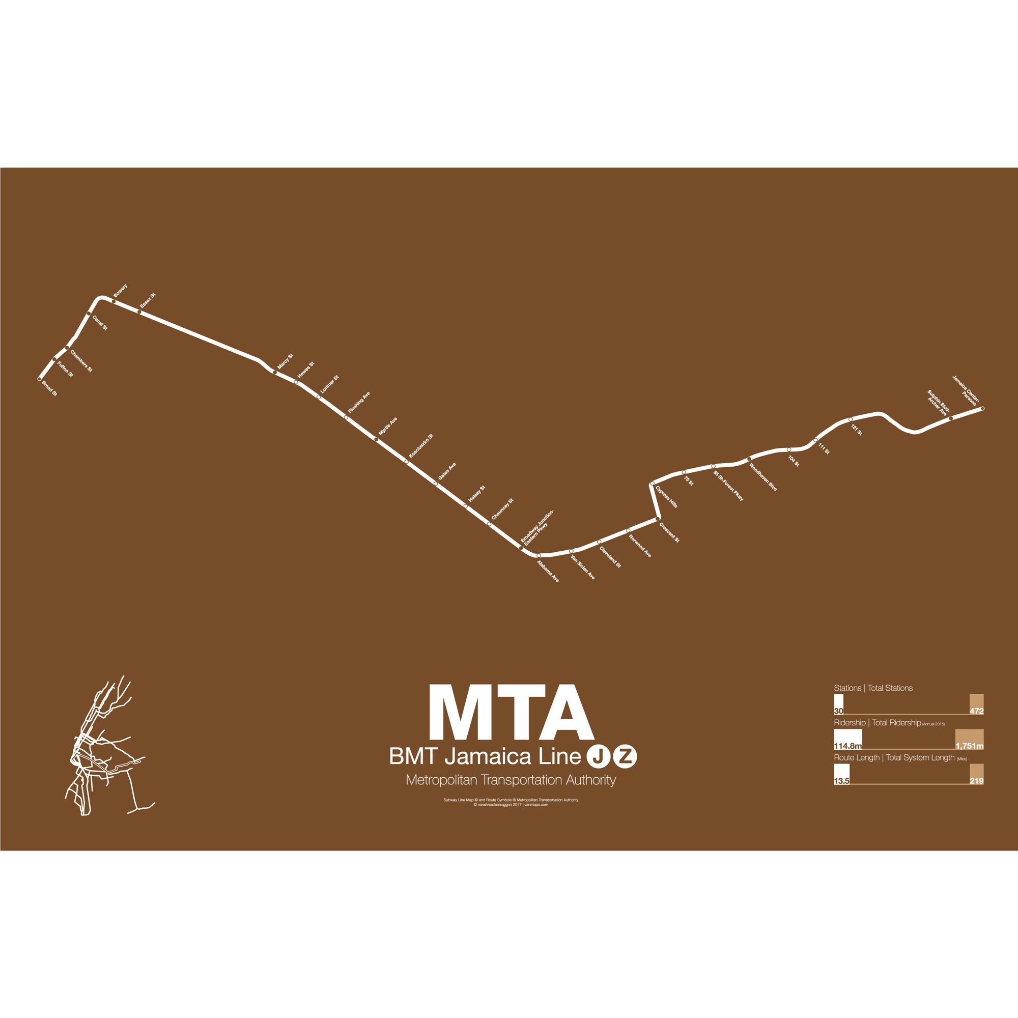
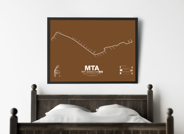
The BMT Jamaica line is the second oldest continually operated rapid transit line in all of New York City (behind the Franklin Ave shuttle). Originally an elevated train from Driggs Ave in Williamsburg to Gates Ave where it connected with the existing Lexington Ave elevated (not to be confused with the Lexington Ave subway in Manhattan). Opened in 1885 the line was electrified and expanded east to Broadway Junction (1893) then to Jamaica (1913). When the Williamsburg Bridge opened in 1903 it was extended to an underground terminal at Delancey and Essex St on the Lower East Side.
In 1918 a subway was opened connecting the existing terminal at Essex St to a new terminal downtown at Chambers St under the newly constructed Municipal Building. While the elevated line in Brooklyn was only 3 tracks (2 in many places) the new subway under Delancey and Centre Sts was 4 tracks and allowed for express service. The subway was further extended to connect to the new BMT Broadway line subway for service back into Brooklyn.
Three trains run along the BMT Jamaica line. The J/Z runs local from Broad St in Manhattan weekdays (rush hours) and Chambers St all other times to Marcy Ave. After Marcy Ave at rush periods the J runs express to Myrtle Ave and Broadway Junction (running local all other times). After Broadway Junction the J and Z trains operate “skip-stop” service where each train alternates stops. Thus each train only stops at half of the stations. The original elevated track through Jamaica Center was demolished in the 1979 and service was rerouted along the new subway under Archer Ave.
M trains once ran along an elevated line, the Myrtle Ave elevated, from downtown Brooklyn out to Middle Village-Metropolitan Ave. In the 1950s the section of track from downtown to Broadway (Brooklyn) was torn down and service was run from Broad St to Middle Village along the northern portion of the tracks. The M train made this run until 2010 when it was rerouted through the Chrystie St cut to run as local service along 6th Ave. On nights and on weekends the M train is cut back to a shuttle service from Myrtle Ave to Middle Village.
Printed on Satin finish 80# cover stock – 220 GSM. Made in the USA! Standard production time is 5 days. Allow more time for shipping.
Select options This product has multiple variants. The options may be chosen on the product page -
 $30.00 – $80.00
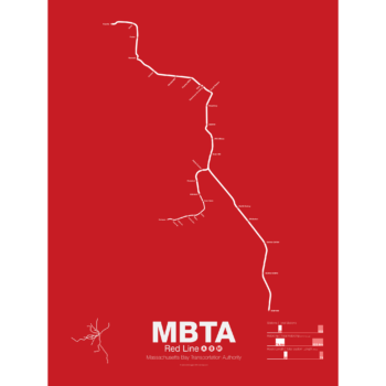
In 1912 the Red Line benefited from being the last of the original subways in Boston to open. A decade of subway building allowed the Red Line to be designed with larger trains and platforms that were easier to navigate (unlike the disconnected Orange Line platforms). Planned as an elevated subway until the citizens of Cambridge objected, the original route connected Harvard Sq. with Park St. At Harvard Sq. a parallel subway was built for trolleys to transfer commuters from the northwestern suburbs and is still in use today.
The Red Line was quickly extended to South Boston and large transfer stations were built at Broadway and Andrew Sq. to collect trolley (and later bus) commuters coming from Dorchester.
In 1926 and 1927 the Red Line was extended to Ashmont in Dorchester along the route of and old commuter rail road. Though the subway was proposed to be extended further to Mattapan the residents of Milton and southern Dorchester opted for a high speed trolley route instead, pre-dating the concept of light rail.
Plans were drawn up to create a new branch of the Red Line to Braintree as early as 1945 but construction didn’t begin for another 20 years. First to Quincy in 1971 and finally to Braintree in 1980 the new branch was designed to bypass Dorchester for a quicker commute.
At the other end the Red Line was extended northwest from Harvard Sq. to Alewife in 1985. Originally planned to run out to Lexington along the abandoned Boston and Maine Railroad the line was cut back when residents of Arlington protested.
The Red Line runs two heavy rail routes, Alewife-Ashmont and Alewife-Braintree (which skips Savin Hill).
A light rail section runs from Ashmont to Mattapan using refurbished PPC trolleys from the 1940s.
Printed on Satin finish 80# cover stock – 220 GSM. Made in the USA! Standard production time is 5 Days. Please allow more time for shipping.
Select options This product has multiple variants. The options may be chosen on the product page -
 $30.00 – $80.00
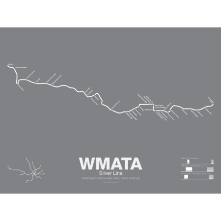
The Silver Line is the newest section of the Washington DC Metro with the section between East Falls Church and Wiehle-Reston East opened in July 2014 and the extension to Dulles Airport and Ashburn opened in 2022. The Silver Line shares much of its track with both the Orange and Blue Lines as it runs through downtown DC but branches off the Orange Line after East Falls Church station.
The Silver Line was built in most places along the median of the Dulles Access Road which itself was built in the 1960s with space left for a future rail line. Besides providing a direct link between DC and Dulles the Silver Line is also designed to mitigate the suburban sprawl in the Virginia suburbs which developed after the highway was opened. Tysons Corner, especially, will benefit as the Silver Line was routed through the center of town in order to support more traditional urban developments.
Printed on Satin finish 80# cover stock – 220 GSM. Made in the USA! Standard production time is 5 Days. Please add more time for shipping.
Select options This product has multiple variants. The options may be chosen on the product page
Reviews
There are no reviews yet.