transit authority
-
 $45.00
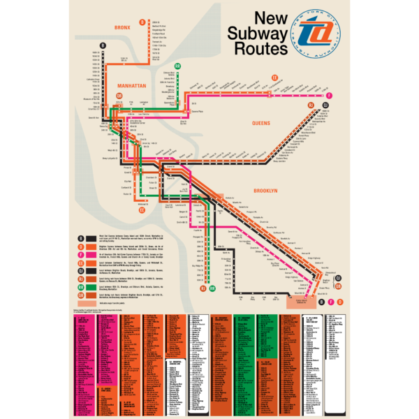
“I defy anyone to take this psychedelic creation and figure out how to get anywhere!” -State Senator Albert B. Lewis 1967.
The Chrystie Street Connection didn’t just revolutionize how commuters got around by creating new subway lines but it also helped usher in a new era of modernist wayfinding and system maps. Chrystie St took a decade to build and knit together the once separate BMT and IND subway systems to create a new network which we still use today. This map was part of a brochure issued when the first new lines were opening in November 1967. This map was the first to introduce the idea that each line would be shown with its own color and lettered bullet, simplifying naming conventions. For a further look at the Chrystie St Connection check out my blog post!
This map has been carefully recreated down to the exact typeface. Included at the bottom was the reverse side of the original brochure, featuring a station by station listing of each new line. Printed on Satin finish 80# cover stock – 220 GSM, 24″ x 36″.
-
 $45.00
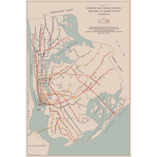
There are two “official” maps of the IND Subway’s expansion plans from the 1930s, colloquially known as the Second System. The plans for expansion evolved greatly as the IND was built. In the 1930s, the New York City subways were still operated by three separate companies. In 1940 the two private companies, the IRT and BMT were purchased by the City of New York under a unification plan. Thus, subway planners were able to imagine physically combining the three systems.
In 1940, John Delaney, Chairman of the Board of Transportation, outlined a new plan, with some additions in 1943. Until now, there were no maps of this plan. So I made one! The 1943 Lost IND Second System Map is probably the last time the city thought about such a large expansion program. The map here is based on the design of the 1939 map, with some changes.
To learn more about the history of this map, and see an outline of the ideas it shows, check out my post.
Printed on Satin finish 80# cover stock – 220 GSM, 24″ x 36″.
-
 $30.00 – $80.00
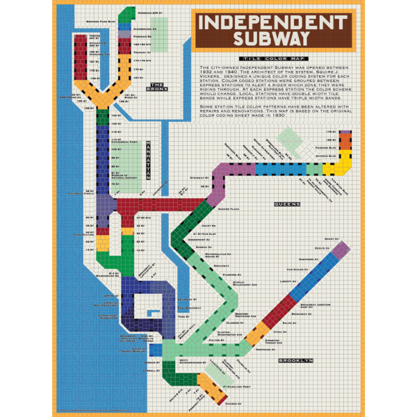
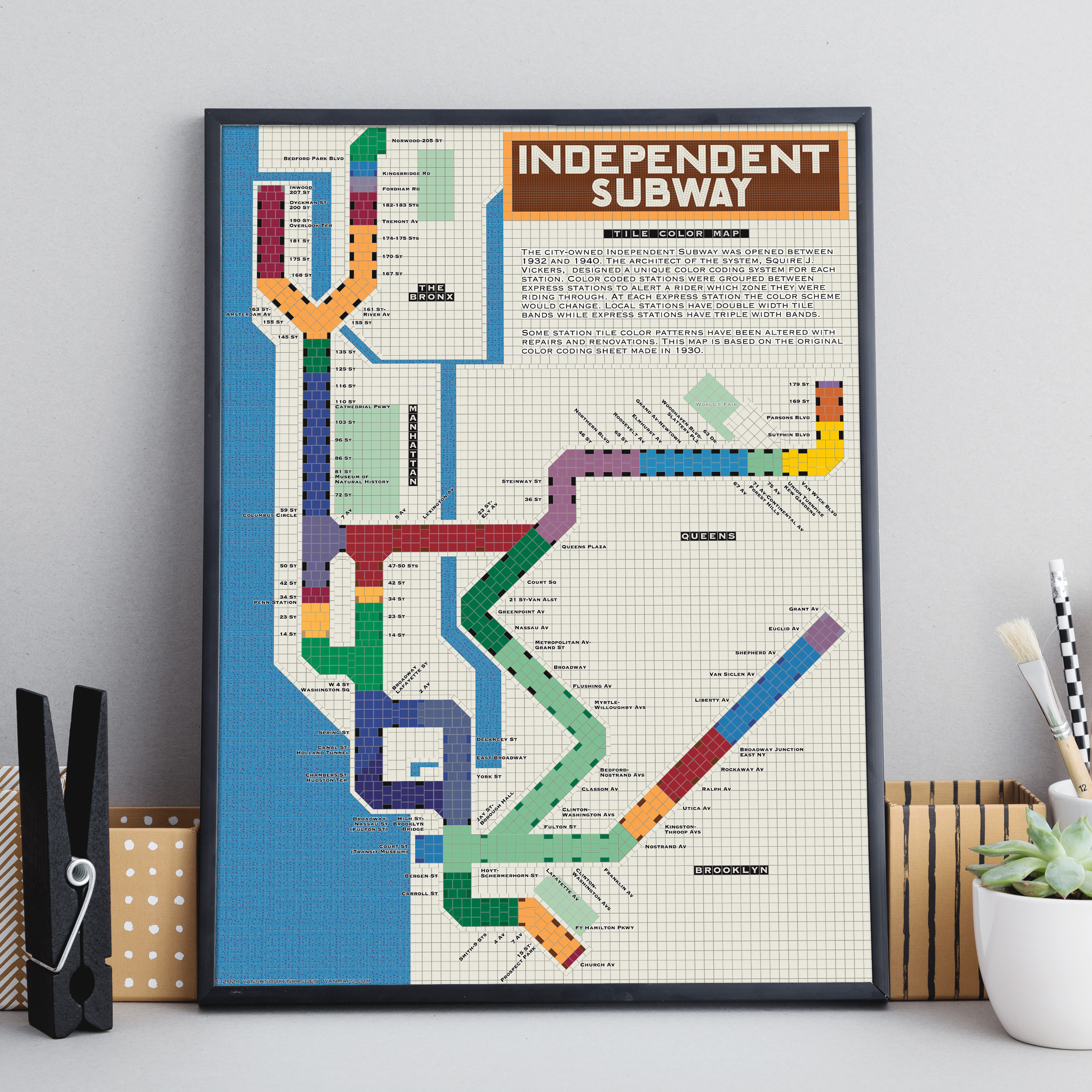
The City of New York built Independent Subway (A/B/C/D/E/F/G trains) was opened between 1932 and 1940. All the subway stations at the time featured tile bands and art unique to each station. The IND’s architect, Squire Vickers, created a new tile pattern based on color theory. He grouped express and local stations with color so that each time a rider rode through an express station the color of the tiles would change. He created a modern, streamlined design which featured two colors per station. The idea was that a rider would recognize their station’s color and know when to get off. This map shows how each color group looks when laid out like a subway map.
Note: The design features an orange tile outline. Some frames may obscure this outline.
Printed on Satin finish 80# cover stock – 220 GSM, 18″ x 24″.