A while ago, as more of a challenge to myself, I drew a couple maps of what New York City would look like if Robert Moses had been able to build his Lower-Manhattan Expressway and Mid-Manhattan Expressway. I’ve been interested in unbuilt highways for a while, and usually drew out quick sketches on Google Maps. But that isn’t really enough, no. I want a real map of what these cities would look like. Since my Robert Moses maps I’ve gotten great responses, many people asking me to make similar maps for their cities. I was way ahead of them.
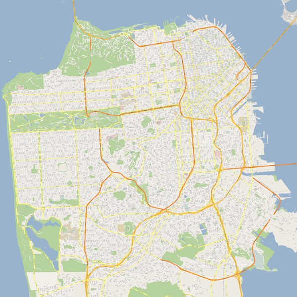
Now I’m back in the highway groove. Presented here is the first of a series of unbuilt highway Google Maps: San Francisco. The research wasn’t as in depth as with the New York maps, only because since so many of these roads never got off the drawing boards there wasn’t much to go on, and I had to imagine much of it (most of the off ramps are purely speculative). But the core idea is still there; what would it look like?
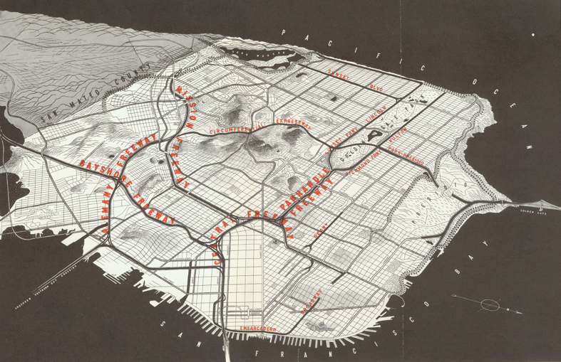
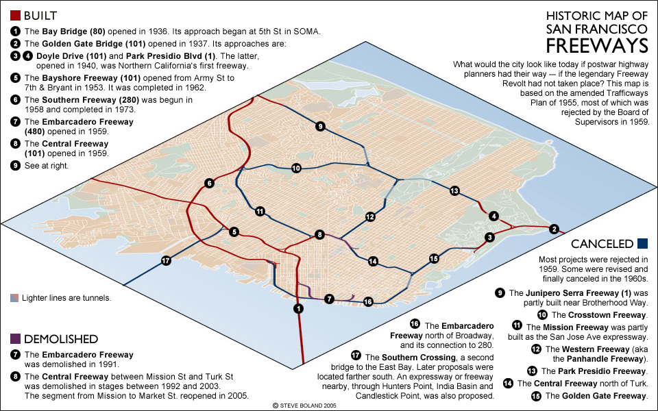
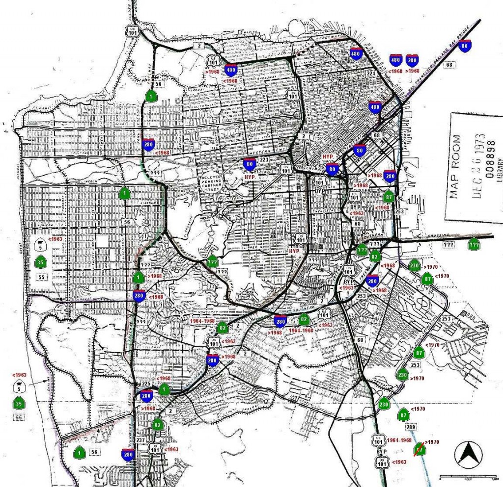
Like in many other cities in America in the 1960s, the people of San Francisco began to question the logic of destroying swaths of their city to build intrusive highways which would only serve people who didn’t even live in the city. The Freeway Revolt spread across the nation and stopped many roads high in the air. Most of the maps and plans have been summed up nicely over at San Francisco Transit Oriented Design. Here are some of the historic maps I used:


Nicely done! How long did this take you?
Here are some 1938 plans for the Mission Freeway.
http://burritojustice.com/2009/09/05/de-elevating-the-mission-freeway/
It would have run between Mission and Colridge at the foot of Bernal Heights, and then passed over Army (Cesar Chavez) and then onto Capp St. It looks like it would have been a sunken into a cut at that point, passing under 24th, 22nd, 21st, 20th, 18th and 16th, while it veered from the western to the eastern side of Capp.
Eric Fischer has many, many more built highway plans on his Flickr feed, including the rest of that 1938 set.